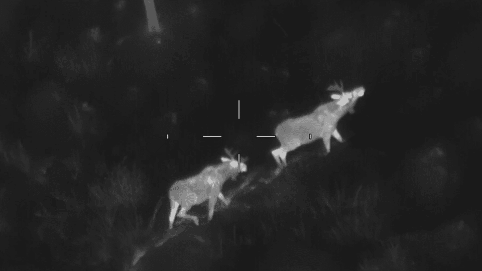
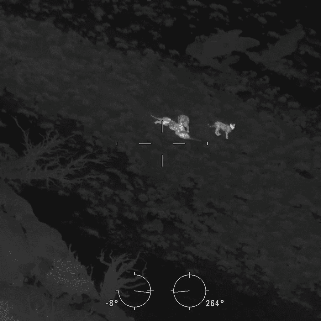
Noninvasive, fixed wing Aerial Infrared (AIR) wildlife surveys planned, flown, and verified in house by seasoned pilots, wildlife biologists, and sensor operators. We deliver high quality, defensible data for wildlife management.
Pioneers of Aerial Infrared wildlife surveys, supporting state and federal agencies across North America.
Defensible results you can stand behind
Non-invasive survey methods
Predictable, end-to-end execution
Need wildlife counts that stand up to review?
Short field windows, vast terrain, and public scrutiny make surveys hard to defend, especially when methods vary or disturbance shifts animals. Our approach is built around noninvasive AIR surveys from altitude, standardized procedures, and an integrated team that keeps coverage consistent and results credible.
Wildlife surveys that hold up in scientific and agency review
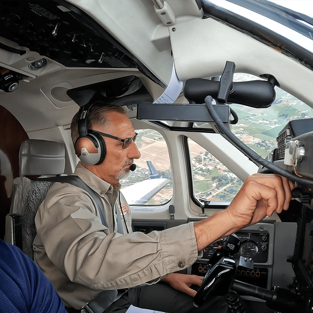
Your missions are executed by our in house crews of seasoned pilots, wildlife biologists, sensor operators, and data scientist. Using fixed wing aircraft and advanced remote sensing, our specialized team gets you the accurate data you deserve.
Why choose OAR?
Defensible results you can stand behind
High quality wildlife counts and habitat mapping. We use documented methods and quality control, so the work is ready for scientific and agency review.
Noninvasive fixed wing coverage
Surveys from altitude minimize disturbance while flying across vast habitats. Fixed wing operations support mission safety for crew and wildlife.
Integrated in house team
Seasoned pilots, wildlife biologists, and sensor operators plan, fly, and verify your mission. One team, one method, predictable schedules, and a single point of contact.
Here's how it works...
Step 01
Schedule a Consultation
We start with your specific scientific questions and define species, area, timing, and species and habitat specific protocols. This gives you a clear survey plan and schedule.
Step 02
We Do The Work
Our in house team of experienced wildlife biologists, seasoned pilots, and sensor operators conducts noninvasive, fixed wing Aerial Infrared wildlife surveys with state of the art sensors, gathering precise data with minimal disturbance.
Step 03
Enjoy The Outcome
You receive high quality, defensible data products such as abundance counts and classifications and other wildlife survey insights that support species monitoring, land management, and long term conservation planning.
See how our wildlife surveys work
Watch The Wildlife Society join us for a ride along that shows how our team conducts fixed wing, noninvasive wildlife surveys, and turns flights into useful information for conservation and land management.