

Owyhee Air Research is a leading aerial imaging and mapping provider that works with the federal government, state wildlife agencies and partners, universities, tribal nations, local governments, and private companies throughout the United States. We use the most advanced technology available in remote sensing and mapping, multispectral imaging, and aerial telemetry to deliver the insights and intelligence that drive critical decisions.
Our Mission And Vision
Our mission is to integrate scientific expertise, advanced sensors, and specialized aerial assets to address complex environmental challenges—delivering intelligent, scalable solutions that drive real-world impact.
Our vision is to create an informed, resilient world by delivering aerial intelligence that advances resource management, conservation, and emergency response.
Who We Serve
Federal Agencies
For over 12 years, we’ve collaborated with federal and state agencies, offering cost-effective solutions for wildlife surveys and fire reconnaissance. Our palatized sensor payloads, combined with advanced telemetry and mapping technology, ensure precise data collection. This enables agencies to make well-informed decisions that protect and conserve natural resources.
Wildlife Biologists
Our team of wildlife professionals has developed habitat- and species-specific survey protocols. These protocols allow for the accurate and efficient collection of diverse wildlife population metrics. Agency biologists use our services to study and monitor animal behavior and habitat. With infrared/HD video and telemetry equipment, researchers can track animal movements. This data helps inform management decisions at the landscape scale.
Land & Fire Managers
For fire managers, we provide essential information for wildfire detection, prevention, and control. Our fire reconnaissance capability allows managers to quickly and accurately assess the fire’s location, size, and intensity. This helps them make informed decisions on the most effective response strategies.
Environmental Organizations
From habitat health assessments to post-fire regrowth monitoring, environmental organizations use our mapping technology to identify high-value conservation areas. This helps them prioritize conservation efforts effectively.
Land Developers
Land developers can leverage our telemetry and mapping services to evaluate the environmental impact of their projects on local wildlife and habitats. Additionally, these services facilitate long-term monitoring of landscape changes, providing valuable insights into the effects of ongoing development.
Researchers & Educators
Researchers and educators can benefit from the full breadth our services to engage fellow researchers, students, and the general public in learning about new methods of data acquisition for wildlife behavior and conservation.


Meet Our Leadership Team

Dan is a Certified Wildlife Biologist through the Wildlife Society with an M.S. in Wildlife Biology/Ecology, and a professional background in Incident Management. He’s been with Owyhee Air for 7 years and established many of the flight protocols we now use for wildlife and wildfire aerial operations and data delivery. Born and raised in the foothills of Southern Idaho, Dan has a deep appreciation for the outdoors where he can often be found exploring new trails and streams in the wild places of North America.

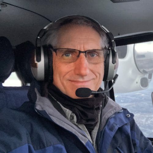
As Director of Operations, Michael is responsible for regulatory compliance with all FAA regulations and is the main point of contact behind our FAR Part 135 Operations Certificate. Initially inspired by the movie Top Gun, Mike has diligently pursued his aviation career as a pilot,
aviation manager, and consultant. Specializing in the start-up and/or growth phases of air carriers,
Mike has held leadership roles with six different certificate holders, and several other aviation
entities too. As a special passion, Mike enjoys helping individuals develop into the long-term roles
they want to pursue.
The best aspect about being a pilot: “seeing the world from a unique vantage point, from which to
begin a new adventure.” Mike enjoys [nearly] all outdoor activities, most notably hiking and
exploring, swimming, biking, and all self-powered water sports. Mike’s family – at least according
to him – also enjoys exploring the places he sees from the air. In fact, living in north-central Idaho
was the result of a series of flights over an area that required further exploration!
Todd is our Chief Pilot. His passion for aviation took wings at age 17 and has taken him around the world from N. America to the Western and Southern Pacific islands, to the continent of Africa, and now to Owyhee Air Research, where he oversees pilot training and standardization, in addition to operational flying. Over the years he has served in roles ranging from pilot/mechanic to Chief Pilot at a regional airline, to Program / Country Director of a large Humanitarian Air group in Papua New Guinea. He holds FAA Airline Transport, Commercial, and Airframe and Powerplant licenses in addition to a B.S. in Business from Southern Oregon State University.
Born and raised in the Northwest of the US, Todd has a passion for the outdoors, where you’ll find him backpacking, biking, or sailing, as time allows. These interests align well with the natural resources focus of Owyhee Air Research.